SDG Commons

SDG Commons
Location(s)
Tags
SDG(s)
Sustainable Development Goal(s)
Powered by

SDG(s)
Sustainable Development Goal(s)
 2Zero hunger
 8Decent work and economic growth
 9Industry, innovation and infrastructure
Please be aware that the content herein is comprised of personal reflections, observations, and insights from our contributors. It is not necessarily exhaustive or authoritative, but rather reflects individual perspectives. While we aim for accuracy, we cannot guarantee the completeness or up-to-date nature of the content.
Images
Description of the solution
Type of the Solution
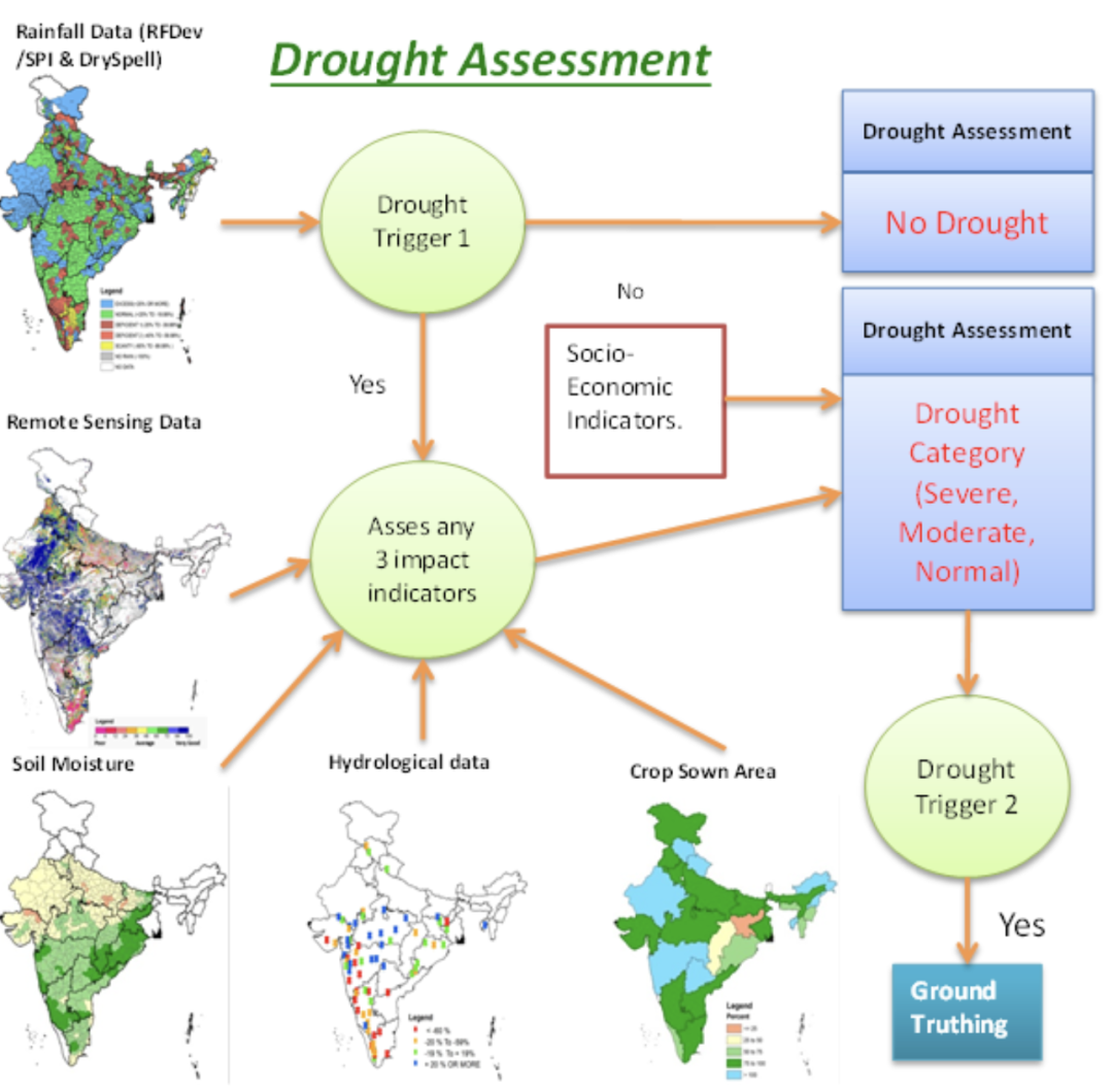
Data_collection
Subcategory
Satellite imagery
Who led the solution
Other public institutions
Timeline for implementation
Medium term (2-4 yrs)
Lifespan of the solution
Additional notes
Link to the solution


Comments
Log in to add a comment or reply.