Disclaimer:
Please be aware that the content herein is comprised of personal reflections, observations, and insights from our contributors. It is not necessarily exhaustive or authoritative, but rather reflects individual perspectives. While we aim for accuracy, we cannot guarantee the completeness or up-to-date nature of the content.
Type of project
Contributory project: It is designed by members of the scientific community, and citizens participate in data collection. Collaborative project: Citizens participate in data collection and analysis. Co-created project: Citizens participate in all stages of the scientific process.
Overall goal
Learn about and characterize routes, weaves, and memories of water in different hydrosocial territories of Córdoba. Build foundational knowledge to serve as a resource for participatory management of hydrosocial territories.
Specific goals
Identify and record the biophysical processes, associated technologies and infrastructure, and the socio-cultural dimension in relation to water. Establish connections among the water routes, production of scarcity, and water quality. Collectively design water sampling and analysis strategies in territories, promoting a potential interaction with scientific-academic, management, or community-based institutions or projects that address water quality studies.
Description of citizen participation
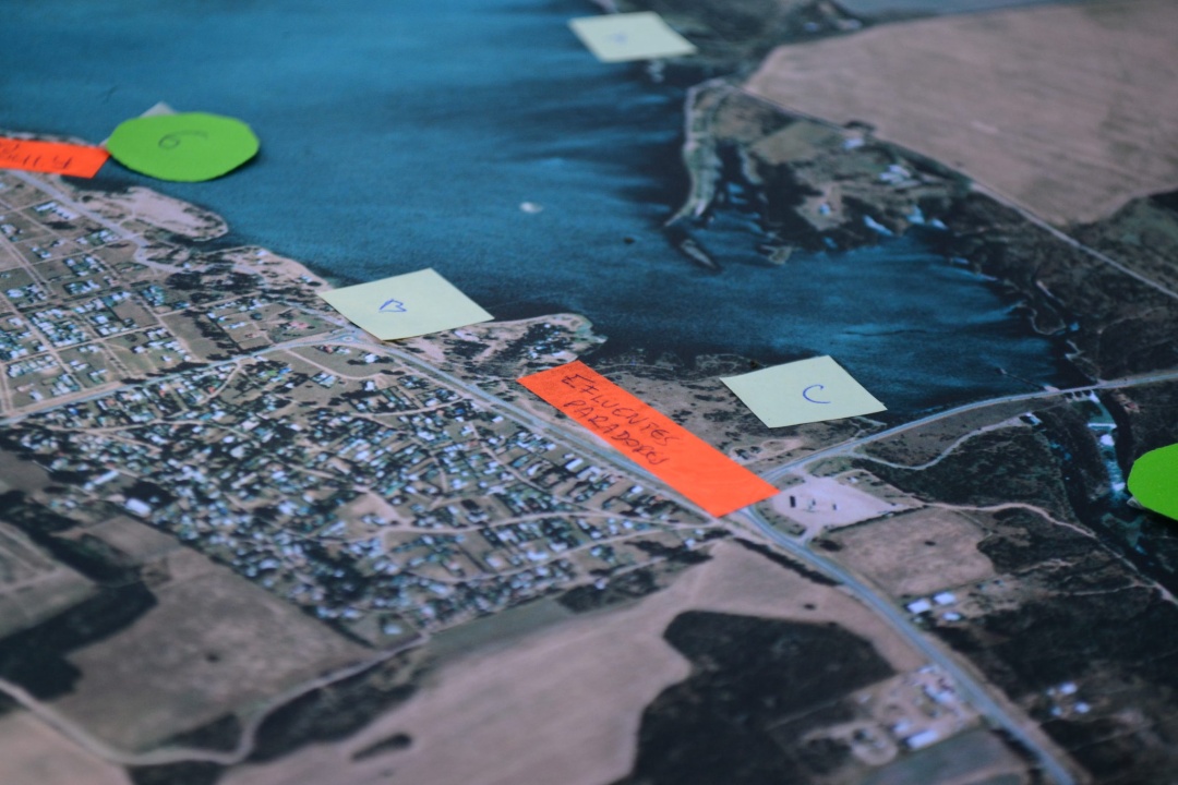
Citizens co-participate throughout the process. Firstly, they participate in the identification of hydrosocial territories affected by water scarcity and quality issues. The communities themselves and the spaces of socio-environmental struggle initially identify the local issues. Secondly, they co-create mapping workshops in the territory with scientists, scholars, and citizens. Thirdly, they collaborate in the collective mapping of the hydrosocial territory, developed in the area affected by the issue, with the active involvement of citizen scientists participating in the project and the community at large. Fourth, they participate in the design of a water sampling strategy and the generated data record. These strategies represent one of the main products of collective mapping. Finally, they are involved in the analysis and sharing of findings with the community at large, as well as in the development of collaborative strategies with state administration bodies and academic institutions. The analysis of mapping activity records and the integration between this analysis and academic knowledge are carried out jointly through work meetings or collective work on digital platforms. Throughout the process, academic knowledge and environmental knowledge/knowledge of inhabiting interact horizontally.
Time Frame
6/1/2022 - N/A.
Project leaders
[REDACTED], Research Center on Earth Sciences (CICTERRA)/National Scientific and Technical Research Council (CONICET)-National University of Córdoba (UNC) and the Faculty of Philosophy and Humanities (FFYH)/UNC [REDACTED], Organización Socioambiental Almaverde
Contact information
[REDACTED]
SDGs
 Consent to share form or official link.

 6Clean water and sanitation
 10Reduced inequalities
 11Sustainable cities and communities
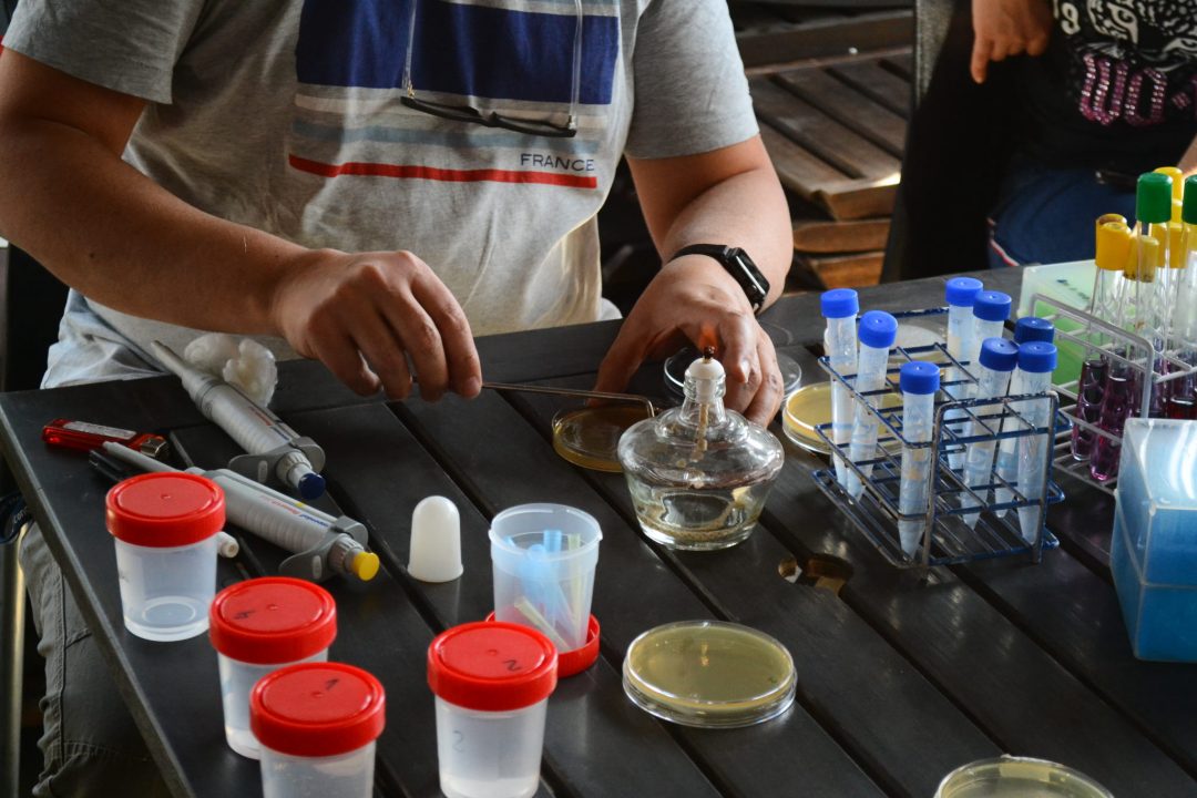


Comments
Log in to add a comment or reply.