Disclaimer:
Please be aware that the content herein is comprised of personal reflections, observations, and insights from our contributors. It is not necessarily exhaustive or authoritative, but rather reflects individual perspectives. While we aim for accuracy, we cannot guarantee the completeness or up-to-date nature of the content.
Co-created project: Citizens participate in all stages of the scientific process
Overall goal: Make progress in the spatial and temporal characterization of sediment transport dynamics in bodies of water in the area of the Río Cuarto (Cuarto River) (Chocancharava), province of Córdoba, Argentina. Specific goals: Determine quantity, quality and size of sediments transported in bodies of water. Characterize spatial and temporal variation in the size of bottom sediment transported in bodies of water. Estimate the rate of bottom sediment transport and suspension in the study area. Transfer the information obtained and the tools developed to sand mine representatives to improve their commercial activities and optimize aggregates extraction. Transfer the information obtained and the tools developed to management agencies to adopt measures to mitigate the impacts of erosion and/or sedimentation generated by inadequate sediment management.
Description of citizen participation: Operators of mechanical sand mines installed on the Río Cuarto riverbed in the province of Córdoba, Argentina, are participating in the first stage of this project on behalf of the community. The work methodology is defined in a co-creative process based on continuous feedback, which includes all stakeholders (representatives of the community, management agencies and academic and research institutions). Furthermore, sand mine operators, with extensive experience in the system under study, make significant technical and scientific contributions related to the evolution over time of the different processes to be studied (hydrology, hydraulics, sediment transport, etc.). More specifically, every month, sand mine operators take bed and suspended sediment samples and repeat this procedure after major flood events. Additionally, operators report rainfall using instrumentation located in each sand mine to correlate the evolution of sediment transport characteristics with existing hydrometeorological conditions. Representatives of academic and research institutions process the samples. The results are then transferred to the community and management agencies for analysis, and to jointly define and evaluate public policies.
Time frame. 10/01/2021– N/A
Project leaders. [REDACTED], School of Exact, Physical and Na�tural Sciences (FCEFyN), National University of Córdoba (UNC) and the National Scientific and Technical Research Council (CONICET) in Argentina. • [REDACTED], Institute of Advanced Studies in Engineering and Tech�nology (IDIT), CONICE
Contact information. Email: [REDACTED]; [REDACTED]; [REDACTED] Web: sites.google.com/view/proyectomasare/ Twitter: twitter.com/ProyectoMasare
 Consent to share form or official link.

 6Clean water and sanitation
 11Sustainable cities and communities
 15Life on land
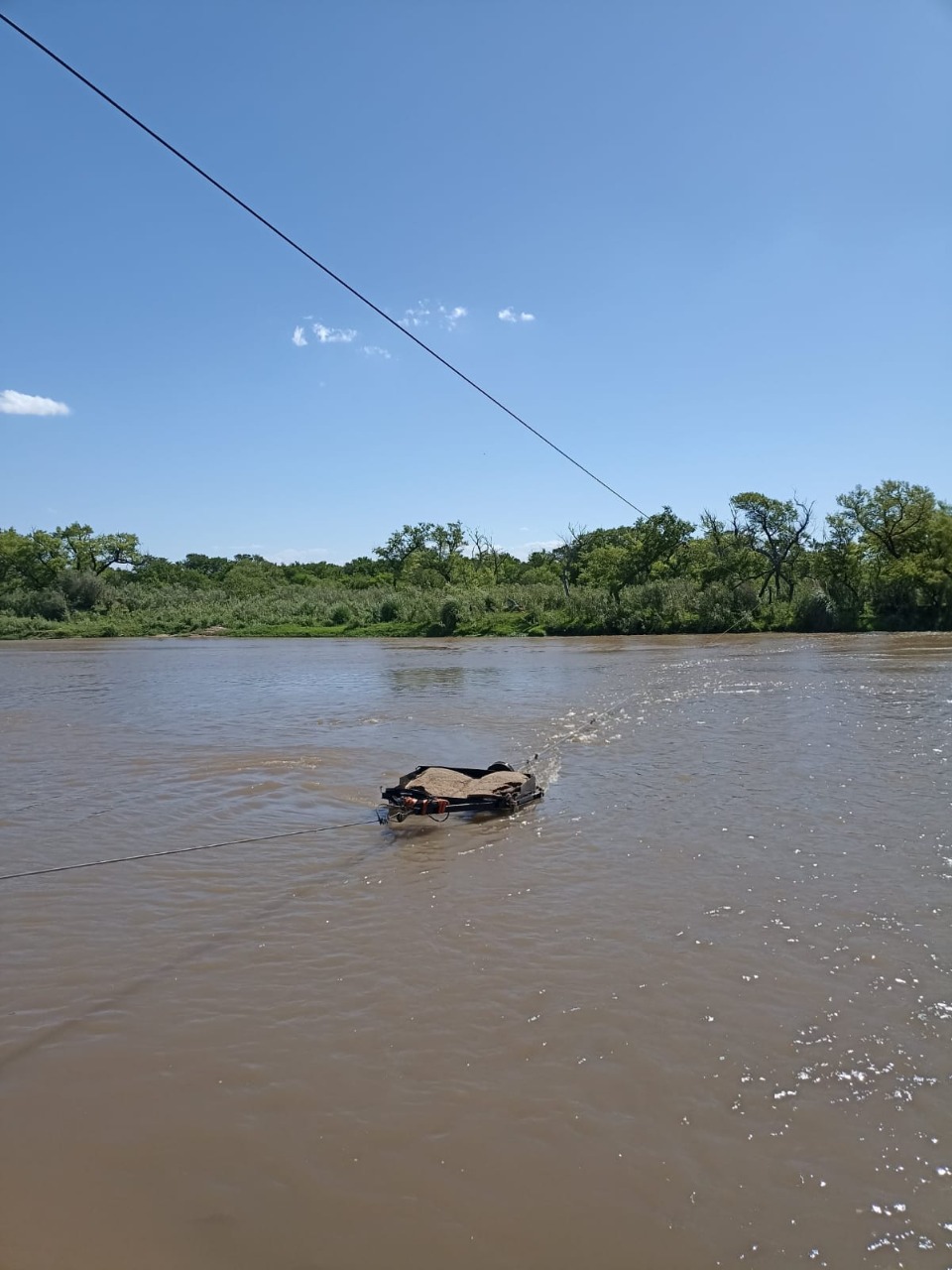


Comments
Log in to add a comment or reply.