Disclaimer:
Please be aware that the content herein is comprised of personal reflections, observations, and insights from our contributors. It is not necessarily exhaustive or authoritative, but rather reflects individual perspectives. While we aim for accuracy, we cannot guarantee the completeness or up-to-date nature of the content.
Co-created project: Citizens participate in all stages of the scientific process
Overall goal: Contribute to disaster risk reduction associated with hydro-meteorological events, through dialogue with territorial stakeholders in order to improve the community early warning system focused on the population. Specific goals: Identify hydro-meteorological monitoring and forecasting needs for the sectors involved. Improve communication, dissemination and interpretation mechanisms for forecasts and alerts. Create a space for permanent joint knowledge building between the academic-scientific sector and the community, as a strategy for social ownership of information about hydro-meteorological events in a given territory.
Description of citizen participation The activities include dialogue and community development of vulnerability and exposure maps describing how water moves in the territory, either due to the overflowing of rivers and streams, and/or rainfall affecting the neighborhoods located along the riverbanks. Prior to the workshop, the scientific-technical sector investigates the issues in each neighborhood to identify characteristics that help explain the water risks. During the workshop, the community is asked to transfer all their knowledge about water risks on a map or a high-resolution photo of their neighborhood. In addition, a tour of the neighborhood is organized in order to identify possible sites where the rain gauge and the level ruler will be installed in a nearby river or stream easily accessible so that observations can be recorded at all times. Community leaders send photos of each device at relevant moments, which are then used to analyze the information during possible flood events. Subsequently, in a final stage, the knowledge is consolidated in a single geo-referenced map that is used by the scientific-technical sector and the community. Thus, parties are involved in the construction of an early warning system.
Time frame. 5/6/2013 - N/A.
Project leaders. • [REDACTED], Sea and Atmosphere Research Center (CIMA)/National Scientific and Technical Research Council (CONICET), University of Buenos Aires (UBA) and the Department of Atmospheric and Oceanic Sciences (FCEN)/UBA. • [REDACTED], CIMA/CONICET-UBA and the Department of Atmospheric and Oce�anic Sciences/FCEN/UBA
Contact information. Email: [REDACTED]; [REDACTED] Web: anticipandolacrecida.cima.fcen.uba.ar/ Instagram: instagram.com/anticipando.la.crecida
 Consent to share form or official link.
 10Reduced inequalities
 11Sustainable cities and communities
 13Climate action
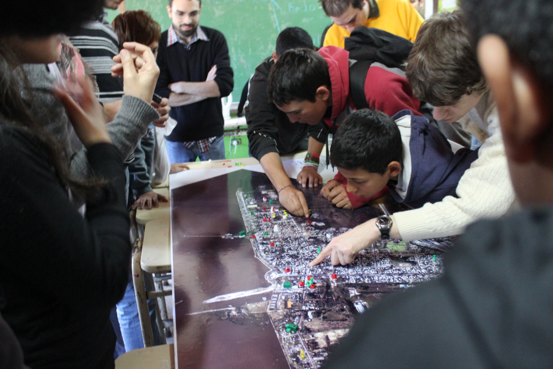


Comments
Log in to add a comment or reply.