Disclaimer:
Please be aware that the content herein is comprised of personal reflections, observations, and insights from our contributors. It is not necessarily exhaustive or authoritative, but rather reflects individual perspectives. While we aim for accuracy, we cannot guarantee the completeness or up-to-date nature of the content.
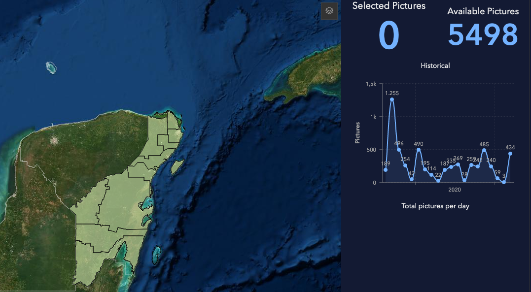
Collective View is a citizen science project that seeks to complement traditional monitoring techniques, supporting validation points that allow Satellite Remote Sensing to improve its levels of precision. The project has been developed by researchers from the Department of Observation and Study of the Earth, the Atmosphere and the Ocean of El Colegio de la Frontera Sur (ECOSUR), Chetumal unit, based on a collaborative scheme for the capture of images, algorithms of artificial intelligence for the automatic classification of photographs and geographic information systems for the visualization of results. The main objective of the project is to generate distribution maps of sargassum along the beaches, using images collected and sent by the society. Through the use of an application available for mobile devices, the citizen can send images of the beach conditions. This information is stored on cloud servers and, later, the images are classified and processed so that various products can be produced, such as, for example, statistics of citizen participation by region or distribution maps of sargassum along the beach. , which in turn can support decision-making.
https://learngis.maps.arcgis.com/apps/opsdashboard/index.html#/fcd1f037f1464992abbf2a7a225459e3
https://play.google.com/store/apps/details?id=appinventor.ai_javier_arellano_verdejo.ERIS_SMS&hl=es
Source: Article on Este País newspaper by [REDACTED] y [REDACTED] -15.12.2020
https://estepais.com/home-slider/monitores-del-sargazo-mediante-ciencia-ciudadana/
 Consent to share form or official link.


 6Clean water and sanitation
 13Climate action
 14Life below water


Comments
Log in to add a comment or reply.