Disclaimer:
Please be aware that the content herein has not been peer reviewed. It consists of personal reflections, insights, and learnings of the contributor(s). It may not be exhaustive, nor does it aim to be authoritative knowledge.
Title
Please provide a name for your action learning plan.
WeMapp- purpose-driven tech solution for people-centered and inclusive public spaces
Challenge statement
Challenge type: If you are working on multiple challenges, please indicate if this is your "big bet" or "exploratory" challenge.
Please note: we ask you to only submit a maximum of 3 challenges - 1x Big Bet, 2x Exploratory. Each challenge must be submitted individually.
EXPLORATORY
Challenge statement: What is your challenge? (Please answer in specific terms: "Our challenge is that...”.)
Our challenge is to support the co-creation of a community-based digital platform that enables people with mobility difficulties, and all others, to travel efficiently and independently by providing personalized routes based on motor ability through a map containing route obstacles and accessibility information.
Background: What is the history of your challenge? What is causing or driving it? Who is involved? How does the current situation look like? What undesired effects does it produce?
Accessibility of public spaces isn't a feature; it's a fundamental human right. According to the World Health Organisation, around 80 million people globally have some form of motor disability. That number reaches almost 175,000 in Bosnia and Herzegovina and 30,000 in Sarajevo as the capital. At the same time, they all face identical problems, and those are mostly related to the accessibility of public spaces and freedom of movement. In late 2021, Accelerator Lab joined forces with [REDACTED], a young and enthusiastic social entrepreneur and innovator, to support her in the development of WeMapp as the first as a community-based digital platform that enables people with mobility difficulties to move safely and independently by providing personalized routes based on the motor ability for them through a map that contains route obstacle and accessibility detection (powered by Artificial Intelligence). In a desire to open the ideation and design process to the public and co-create the app's feature right from the start, in October 2021, we organized onsite consultation events in a format of "Ena's rolls". Also, we launched the survey to learn what challenges people encounter in everyday traveling or visiting public spaces in urban areas of Bosnia and Herzegovina. To raise awareness about this important issue, in December 2021, we initiated a comic-book-style series of social media content to depict in an unusual but very illustrative way Ena's story and everyday struggle in simple activities and tasks as she is also one of the wheelchair users.
Quantitative evidence: What (official) data sources do you have on this challenge that better exemplifies the importance and urgency of this frontier challenge? You can add text, a link, or a picture.
Outdated data from the last Census from 2013.
https://www.popis.gov.ba/popis2013/mapa/?lang=eng
Qualitative evidence: What weak signals have you recently spotted that characterizes its urgency? Please provide qualitative information that better exemplifies the importance and urgency of this frontier challenge. You can add text, a link, or a picture.
Anecdotal evidence suggests that there are 175,000 people with a motor disability in Bosnia and Herzegovina, out of which 30,000 live in Sarajevo.
https://www.ba.undp.org/content/bosnia_and_herzegovina/en/home/Blog/What-if---a-purpose-driven-tech-solutions-make-cities.html
Value proposition: What added value or unique value proposition is your Accelerator Lab bringing to solving this challenge? Why is it your Lab that needs to work on this challenge and not other actors within UNDP, other stakeholders in the country respectively? Why is it worth investing resources to this challenge?
Co-creation and support in developing a WeMapp application as a one-of-the-kind route planning application will enable people with motor disabilities, mothers with small children in strollers, cyclists, etc., to better plan their individual and everyday traveling, transportation, and usage of urban public spaces and build environment. By including the communities in the design through various consultations and data collection through the organization of data maphaton (inspired by the similar experience from the AccLab Ukraine), the AccLab in Bosnia and Herzegovina will be focusing on bringing a specific set of skills and knowledge (e.g., collective intelligence method, mapping skills, etc.) into the development of such an important application.
Short “tweet” summary: We would like to tweet what you are working on, can you summarize your challenge in a maximum of 280 characters?
Small WeMapp data contribution today - more accessible urban spaces for everyone tomorrow! WeMapp - because urban spaces must be accessible to everyone!
Partners
Who are your top 5 partners for this challenge? Please submit from MOST to LEAST important and state Name, Sector and a brief description of the (intended) collaboration.
Please state the name of the Parter:
Potential informal partner: Ministry of Programming (MoP)
What sector does our partner belong to?
Private Sector
Please provide a brief description of the collaboration.
Different types of support in organizing data maphaton and developing WeMap platform applications.
Is this a new and unusual partner for UNDP?
No
Who are your top 5 partners for this challenge? Please submit from MOST to LEAST important and state Name, Sector and a brief description of the (intended) collaboration.
Please state the name of the Parter:
Potentil partnertner: Secondary School of Civil Engineering and Geodesy
What sector does our partner belong to?
Academia
Please provide a brief description of the collaboration.
Support in organizing data maphaton and collection of data necessary for development of accurate map on WeMap platform applications.
Is this a new and unusual partner for UNDP?
No
Learning questions
Learning question: What is your learning question for this challenge? What do you need to know or understand to work on your challenge statement?
If the community is meaningfully included in the design, (data) mapping, and development process of the WeMapp applications, its features would be better suited to their needs. If provided with a digital tool such as WeMapp, people - not just persons with motor disabilities - would be able to plan their route properly and according to their specific abilities and needs; have a more efficient traveling experience from point A to point B, and make the best use of urban public spaces and build environment. If the community is engaged and supports data collection and onsite mapping, the Wemapp application could showcase the actual scale of the problems of inaccessibility of urban areas in Sarajevo (for a starter).
To what stage(s) in the learning cycle does your learning question relate?
Sense, Explore, Test
Usage of methods: Relating to your choice above, how will you use your methods & tools for this learning question? What value do these add in answering your learning question?
The purpose of engaging the community in the design, data collection, and development process is to inspire co-creation on the one hand. But also on the other, to introduce and support the utilization of citizen-driven data and collective intelligence methods, and combine data, technology, and people's knowledge to be able to showcase the real scale of the urban inaccessibility problem in Sarajevo and provide scalable solutions that could play a vital role in future urban planning strategies and infrastructure activities in terms of available data and insights.
Existing data gaps: Relating to your choice above, what existing gaps in data or information do these new sources of data addressing? What value do these add in answering your learning question?
Some of the data gaps (in currently available map apps in the country): No info on inclination (uphill and downhill) No information on curbside/ sidewalk - is it in line with the road or is there a curb, what's the height of the curb, etc. No information on sidewalk width No information on holes on the road No information on the width of the front door or any kind of door in the public institution, restaurants, cafes, museums, etc. No information on lifts and steps (and their width) in a public building No information on path/road surface( flat, paved, cobblestones, gravel, grass, or similar) No public transportation data (which trams or busses have the ramp, their routes, and numbers)... We hope the "data maphathon" could provide info on some of the above-mentioned data gaps for one specific area of Sarajevo (Municipality of Sarajevo). Data collected will be integrated in WeMapp prototype for further testing and replication on other parts of Sarajevo.
Closing
Early leads to grow: Think about the possible grow phase for this challenge - who might benefit from your work on this challenge or who might be the champions in your country that you should inform or collaborate with early on to help you grow this challenge?
If proven successful, the WeMapp application could be easily expanded to include other urban areas in Bosnia and Herzegovina.
END OF ACTION LEARNING PLAN: Thank you! The form saves automatically and your submission has been recorded. You may now exit this window.





 9Industry, innovation and infrastructure
 10Reduced inequalities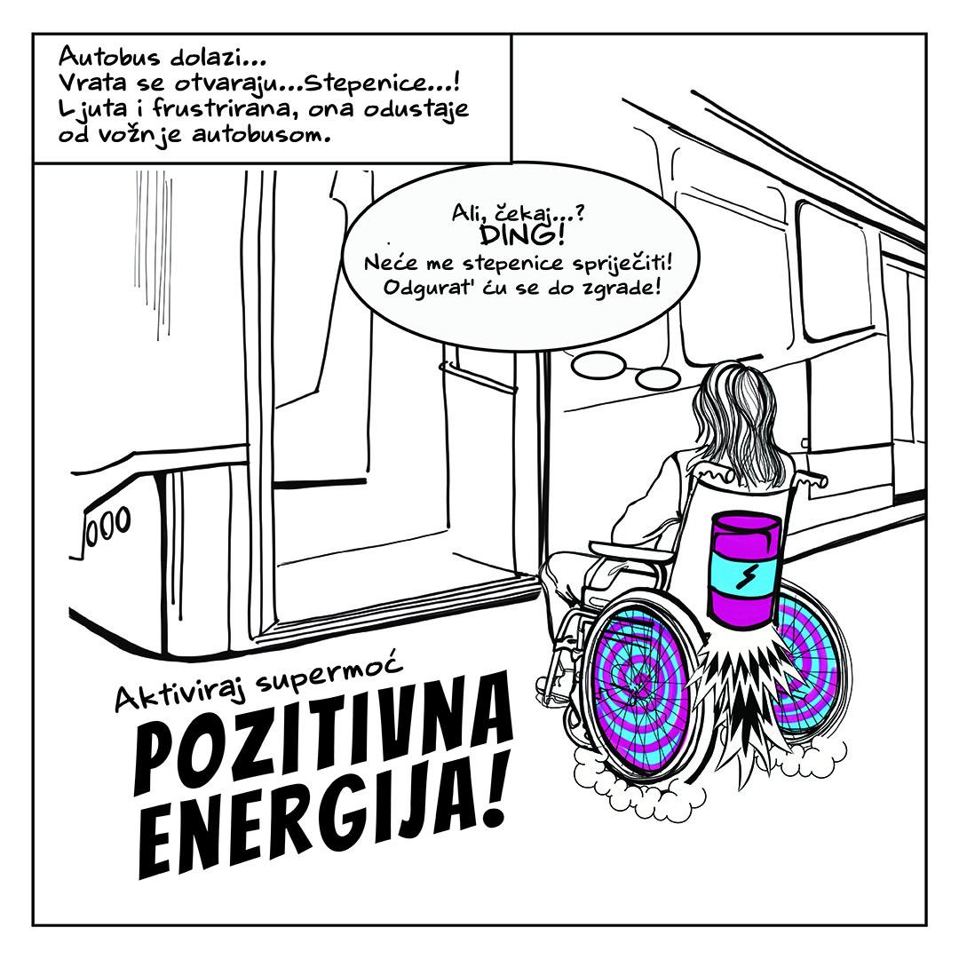



Comments
Log in to add a comment or reply.